




September 28, 2026
 Brian Johnston/USA TODAY NETWORK via Reuters Connect
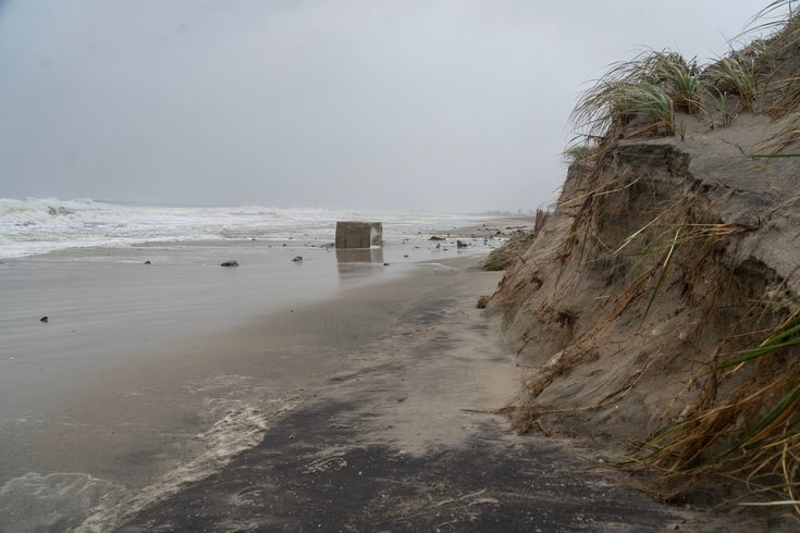
The nor'easter that hit the East Coast over the weekend has caused heavy erosion and flooding at the Jersey Shore. Above, erosion at Bradley Beach in Monmouth County.
The nor'easter that swept the East Coast over the weekend caused the worst erosion and flooding at the Jersey Shore since Superstorm Sandy in 2012.
The storm, which will not fully leave the area until Monday night, washed away dunes and flooded roads in many beach communities, including Atlantic City and Brigantine. Additional rain and other storm impacts could continue throughout the day, weather officials said, but the skies are expected to clear by Tuesday.
PHOTOS: Nor'easter slams Jersey Shore, leaving coastal communities under water
In Atlantic City, the water broke into the dunes and caused steep drop-offs, most notably in a half-mile area around Steel Pier, CBS reported. About half of the dunes are left in the impacted areas, the Atlantic City Beach Patrol said, and the sharp drop-offs will need to be smoothed out so the beach can be accessed again. Beaches have been closed since Friday.
Brigantine also had significant damage to its dunes, and Mayor Vince Sera told NJ.com that about half the beach was gone. Social media photos and videos showed heavy erosion in Ocean City, too.
On Sunday, New Jersey Gov. Mikie Sherrill said the state's Department of Environmental Protection assessed water treatment facilities, dams and beaches ahead of the storm to track damage. Officials are "aware of the current erosion," she said.
As of Monday morning, parts of Atlantic, Cape May, Ocean and Monmouth were still under an advisory or warning for coastal flooding. Water levels in Atlantic City reached their highest point since Sandy, CNN reported. The strong winds pushed the water over 3 feet above the typical level at high tide, and at one point the water was nearly 8 feet above the low tide level. That's about a foot below Sandy's peak impact.
Because of the flooding, some people were asked to evacuate over the weekend, and several were rescued from cars and flooded roads, Sherrill said.
Thousands of people have had their power restored, but some outages remain. As of Monday, PSE&G reported 52 outages affecting 708 people. Atlantic City reported 43 outages impacting 134 people, and Jersey Central Power and Light said 958 customers were still without power. Flooding, road closures and strong winds could delay restorations.
Minor coastal flooding is expected during the morning's high tide, with "spotty moderate" flooding possible in the back bay areas, the National Weather Service said. Some roads remain flooded, and meteorologists said it will take more time for water to recede.
As of 4 a.m., the storm was drifting around the New Jersey coastline, and is expected to bring rain and winds to the region through the end of Monday. The storm is expected to move into the Gulf of Maine by Tuesday and continue into Canada.
The Jersey Shore can expect another 0.1 to 0.5 inches of rain before the storm passes. The weather will begin to clear up Tuesday morning, and sunshine and high temperatures in the 70s are forecast through the end of the work week. There's a chance of rain Friday night.
A state of emergency issued for eight counties on Friday remains in effect. However, Sherrill ordered state offices to reopen at 11 a.m. Monday.