





October 28, 2026
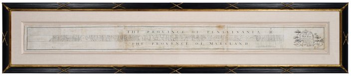
 Provided Image/Brunk Auctions
The original copy of the Mason-Dixon Line map will be put up for auction Thursday. The document mapped the boundary between Pennsylvania and Maryland, and was drawn in Philadelphia.
The original map of the Mason-Dixon Line, the boundary between Pennsylvania and Maryland that became known as the division between free and slave states, is being put up for auction Thursday.
The map was hand drawn and published in Philadelphia in 1767 and 1768 after years of land surveying and measurements by surveyors Charles Mason and Jeremiah Dixon. For decades, it was under the care of a family with ties to William Penn, but it since has been twice sold at auction – in 1982 and 2002.
MORE: Julian McCullough jokes about his Philly roots and rat birth control on 'The Tonight Show'
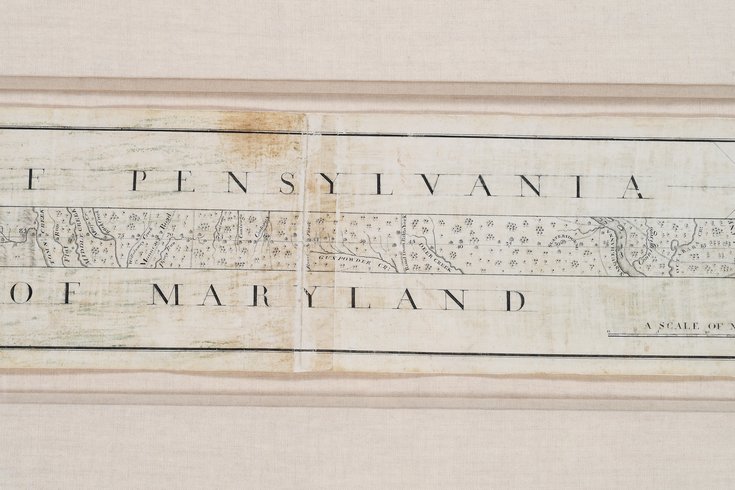
The map is being sold through Brunk Auctions, which expects it to fetch $800,000 to $1.2 million. The map itself is six inches tall and 76 inches long, though it's bordered by Japanese rice paper.
The Mason-Dixon line created a firm boundary between Pennsylvania and Maryland, which were provinces of England at the time the boundary was settled. During the Missouri Compromise in 1820 and in the lead-up to the Civil War, the border was used to divide the North and the South into free and slave states.
The map was gifted to Benjamin Chew, the lawyer who represented descendants of William Penn. When the Chew family papers were sold in 1982, Forbes founder Malcom Forbes bought it for $360,000. The Library of Congress also bid on the document and lost. In 2002, a private collector bought it at an auction for $556,000.
Though it's privately held — and hung in a hallway at a home, according to Brunk — the map has been available to institutions and was on loan for an exhibit at Colonial Williamsburg at one point. Still, the fact that it's not a public document makes the sale exciting, said Lauren Brunk, vice president of Brunk Auctions.
"The Mason-Dixon map, it's not a discovery, but it's been in in a private collection, so it feels like a discovery because it hasn't been in public view," Brunk said.
The expected sale price is about the same as what it sold for in 2002 after being adjusted for inflation. It's hard to say who the buyer will be at this point, but Brunk said it could be another private collector, an institution focused on the Colonial period or a foundation that loans maps and other documents to schools and museums.
The original map of the Mason-Dixon Line, above, is 76 inches long and six inches high.
With new ownership, she's eager for the possibility of even more discoveries about the document.
"There's a couple of different stories here that I think are interesting, and hopefully whoever ends up being the next person to own it will explore them in a way that we just haven't really had time to," Brunk said.